


Finally seeing a promising rain pattern in the Ozarks
It's been a dry end to summer. Many areas in the Ozarks have received only 25% of normal rainfall since mid-July, putting a strain on the local vegetation. We've had widely scattered rain & storms in the Ozarks over the past two days, with more of the same expected in Western Missouri today. Better coverage of [...]
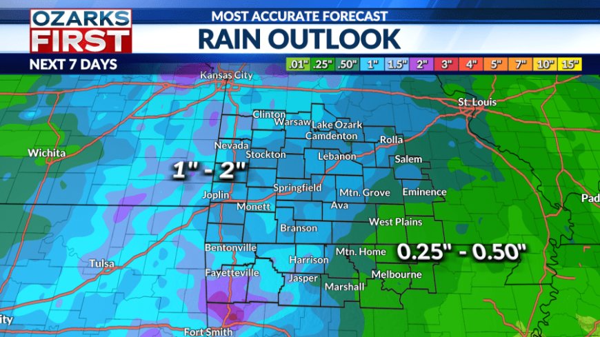
It's been a dry end to summer. Many areas in the Ozarks have received only 25% of normal rainfall since mid-July, putting a strain on the local vegetation.


We've had widely scattered rain & storms in the Ozarks over the past two days, with more of the same expected in Western Missouri today. Better coverage of rain can be expected on Thursday and early next week.


In addition to the stray storms out west, temperatures were also warm. Springfield tied the daily record high temperature at 95°. Today will be similar, although maybe a degree or two cooler.


We've been watching a storm system to our northwest that's expected to pass by the region on Thursday. This storm will boost rain chances Thursday afternoon into Friday morning with scattered rain and storms. This means some areas won't see rain. The risk for rain should shift east on Friday afternoon.


This weekend definitely looks cooler than last weekend. We'll trade the 90s for the low to mid-80s with a cold front arriving Thursday night/Friday morning. The risk for scattered showers will linger into Saturday and Sunday, especially in the afternoons.


Another cool front will approach early next week, generating scattered showers and thunderstorms on Monday. Drier weather will move in behind the front. We're probably not done with hot September weather, with another burst of heat showing up later next week.
What's Your Reaction?


