


Flooding the zone with sunny skies and hot temperatures
A summer ridge is causing temperatures to rise, with heat indices in the low 100s, and a Heat Advisory in effect, though relief may come in early August as the ridge shifts west.
Temperatures continued to edge higher Tuesday, matching our hottest temperatures of the summer in some locations. Now, we're set to go even higher as a summer ridge takes full control of our pattern through at least Thursday.

One note: the Extreme Heat Warning was traded out for a Heat Advisory. This is because the current heatwave is underperforming so far. Heat indices over the past several days have been in the 100 to 105°. This matches the criteria for a Heat Advisory better than an Extreme Heat Warning (issued when heat indices are expected to approach 110°).

The wet spring and summer have made for lush conditions across the Ozarks. But as the ground dries out, the grass and trees may begin to struggle, and lose some of their vibrant green color. This will make it easier for temperatures to soar under the summer sunshine. In the short term, though, the current setup will likely hinder highs a bit.


That said, the summer ridge is still providing a boost, and afternoon highs are expected to slowly climb through at least Thursday.

It will also be a very sunny pattern as the atmosphere dries out. Humidity levels at the surface will also be a bit lower. This will allow morning temperatures to get a bit cooler and also keep afternoon heat indices generally in the low 100s.


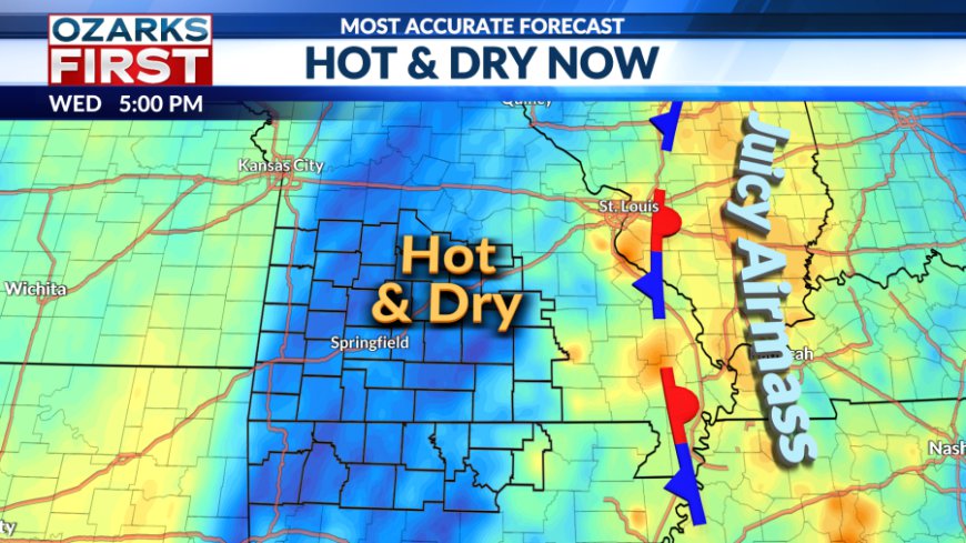
There may be an opportunity for more clouds and even a little rain starting Friday and continuing through the upcoming weekend. An area of unsettled weather will move around the summer ridge before shifting east through Missouri and into Illinois through Sunday. This should weaken the ridge somewhat and juice up the atmosphere with moisture.

At this stage, this looks like only a small speed bump in what will overall be a hot and mostly dry pattern through the end of the month.

After that, maybe some relief. The summer ridge is expected to shift into the West during the first week of August. This will open a path for cool fronts to drop south through the Ozarks. That should mean some rain and an easing of the heatwave in early August.
What's Your Reaction?


