


Friday, July 18 forecast: Next up, searing summer sunshine
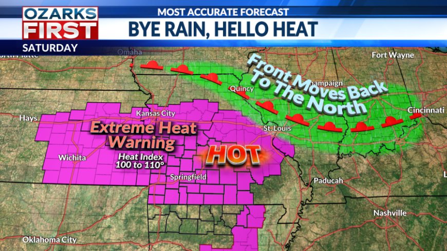
An Extreme Heat Warning has been issued for the region starting Saturday, with temperatures expected to feel like 100-106° through at least Wednesday of next week, and there is no signal for a shift away from the hot and dry pattern through July.
Friday was the day, the day where we shifted into full searing summer sun mode. We had one last shot at showers with the shift in the pattern. Rain was scattered, but locally heavy early in the day over Southwest Missouri and Northwest Arkansas. By afternoon, rain chances had shifted east, and hot weather was building in from the southwest.


The front will shift north of the area by Saturday, with a hot air mass building in. There may be a limited risk of rain with a boundary dropping in from the north close to Central Missouri. And, there may be a few pop-up showers east of Hwy. 63 Saturday afternoon. But, for the rest of us, it will be bright and dry. Saturday is shaping up to be the hottest day so far this summer, and this heatwave is just getting started.


An Extreme Heat Warning has been issued for most of the region, starting Saturday and continuing through at least Wednesday of next week. Hot afternoon highs will come with "feels like" temperatures in the 100 to 106° range.
Time to get prepared for this extended period of excessive heat. Make sure your AC is running properly and that you have adequate water and shelter for outdoor pets. This will also be a stressful period for your body when doing outdoor activities. Remember to stay hydrated and take breaks when working outdoors more often.


Sunday through next week will remain bright and dry. Temperatures will gradually climb as the air mass slowly heats up and conditions dry out across the Ozarks. By the second half of next week, we'll likely have highs in the mid to upper 90s.

There currently isn't much of a signal for a shift away from the hot and dry pattern through the end of July. The only hope is for the summer ridge to shift far enough west to allow a backdoor front to clear the area.
What's Your Reaction?


