Thursday, December 12 forecast: Parade of storms starts this weekend
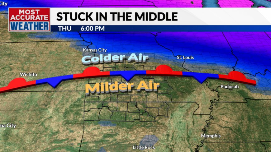
Southerly winds blew in a December delight today. Temperatures started to climb before sunrise, hitting 60° this afternoon in Springfield. It was a warmer day across the Ozarks thanks to a warm front that pushed across Southern Missouri, but the warmup was not equal across the area. Highs closer to Central Missouri only managed to [...]

Southerly winds blew in a December delight today. Temperatures started to climb before sunrise, hitting 60° this afternoon in Springfield. It was a warmer day across the Ozarks thanks to a warm front that pushed across Southern Missouri, but the warmup was not equal across the area. Highs closer to Central Missouri only managed to warm into the upper 40s.


The front will sag south to about Hwy. 60 tonight with temperatures dipping below freezing to the north, remaining well above freezing to the south.


The front will shift back to the north on Friday, but thickening clouds will hamper the warmup. Temperatures will be cool with highs in the low to mid-50s with breezy southeast winds providing an additional chill to the air.


Our next chance of rain is lining up for Friday afternoon through Saturday morning. Light showers or sprinkles will show up over far Western Missouri by early evening Friday. The overnight hours will turn wet as waves of showers move in. Rain or drizzle will continue into Saturday morning before tapering off by early afternoon. The remainder of the day will remain cloudy east of Hwy. 65 where some drizzle will remain possible. Some sun will develop over Southwest Missouri and Northwest Arkansas.

This will be a soaking rainfall with most areas picking up between a quarter and an inch and a half of rain. The heavier amounts will fall to the east.

Temperatures Saturday will be governed by cloud cover and rain. Saturday afternoon will feature a big range in highs with upper 50s to the west and upper 40s to the east.

We'll end the weekend with sunshine and milder weather. Again, clouds and the wind direction could play a role in just how warm, but right now it looks bright enough for highs well into the 50s and low 60s.
Another front will sweep through Monday with a chance for showers and possibly some thunder Sunday night into Monday morning. Temperatures into early next week will run above normal but will trend chillier through the middle of the week when another storm will move through with another round of rain and possibly some thunder.

Looking ahead through Christmas, the Canadian pipeline will open back up later next week with cold air flowing through the weekend before shutting off again in the days leading up to Christmas. There's no sign of significant winter weather through Christmas and a white Christmas is not expected. The pattern looks quiet and seasonable for Christmas Day.
What's Your Reaction?


