


Daily rain chance ahead of Thursday cold front
Scattered rain and storms on Monday brought locally heavy rain and pockets of hail to some, while leaving others high and dry. Rainfall was sporadic. This is happening as the September heat dome is getting squeezed out by storm systems on either side, one to the southeast and one to the northwest. The corridor of [...]
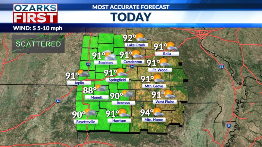
Scattered rain and storms on Monday brought locally heavy rain and pockets of hail to some, while leaving others high and dry. Rainfall was sporadic. This is happening as the September heat dome is getting squeezed out by storm systems on either side, one to the southeast and one to the northwest.


The corridor of wet weather will drift into Western Missouri and Eastern Kansas today. Areas west of Highway 65 will have the greatest chance for scattered rain & storms this afternoon. Like yesterday, rain will be sporadic and amounts will vary.


Temperatures will likely be in the low 90s again today and Wednesday. There is a chance of rain coming from Kansas on Wednesday as a storm approaches from the west, but the rain on Wednesday may run out of gas near the state line. This isn't expected to be the case on Thursday.


The heat dome is completely squeezed out of the Ozarks on Thursday as a cold front breaches the west. The front on Thursday arrives late and will increase rain chances and lower temperatures.


Saturday looks dry for most areas with scattered showers and thunderstorms possible Sunday into Monday as the next cool front approaches. Temperatures from Friday into early next week are expected to run close to normal, with lows in the low to mid-60s and highs in the low to mid-80s.
What's Your Reaction?


