


Heat warning downgraded, but still plenty hot
The extreme heat warning has been downgraded to a heat advisory and while a stationary front has brought some rain and clouds to the region, temperatures are expected to remain in the low to mid-90s with a chance of showers later today.
The extreme heat warning has been downgraded to a heat advisory. This downgrade in messaging is a result of not reaching extreme heat warning criteria of 105° heat index in the past 4 days. Temperatures have largely been running on the cooler side of model guidance because of all the rain earlier this year that has kept things lush and green. It takes more energy to change the temperature of water than air. Therefore, the more water in the ground and the air, the harder it is to get hot.

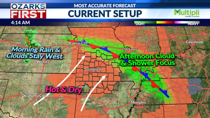
On Monday, a stationary front produced a round of rain and clouds across Central Missouri, bringing temperatures down slightly in that region. This stationary front is still present and isn't producing rain this morning. There is rain, however, in Central Kansas this morning that is quickly fading away. Rain is not expected in Missouri from the rain this morning in Kansas, but some additional upper-level cloud cover can be expected.


The stationary front runs from near Kansas City to the Bootheel. While quiet for now, a few showers may pop up later today near this boundary. Many will stay dry today with temperatures in the low to mid-90s once again.


![]()
There may be an opportunity for more clouds and even a little rain starting Friday and continuing through the upcoming weekend. An area of unsettled weather will move around the summer ridge before shifting east through Missouri and into Illinois through Sunday. This should weaken the ridge somewhat, and it may also push a weak boundary into the area.


At this stage, this looks like only a small speed bump in what will overall be a hot and mostly dry pattern through the end of the month.
What's Your Reaction?


