Heatwave ends today, replaced by rain and comfortable temps
After a long heatwave, cooler temperatures and periods of rain are expected to bring relief, with a chance of thunderstorms in the afternoon and a low risk of severe weather.
After the longest heatwave we've experienced in years, a much-needed change in the weather pattern is finally on the way. The heat concludes today, but not without some trade-offs.

Skies will remain mostly overcast throughout the day, with periods of rain on and off. The focus of rain will primarily be for areas north of I-44 during the morning hours, gradually shifting southward by the afternoon.


Our southernmost counties are under a marginal (1 out of 5) risk for severe weather this afternoon, as a few thunderstorms may develop. I’ll be watching for the potential of gusty winds, lightning, and localized flooding. Thankfully, widespread severe weather is not anticipated.


The silver lining? Temperatures will be much more comfortable. Highs today will only reach the upper 70s to low 80s.

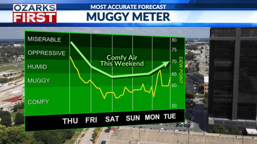
Looking ahead, cooler temperatures are expected to stick around through next week. The weekend forecast looks fantastic for outdoor activities, with highs in the low 80s and unusually low dew points for this time of year.

After today, rain chances appear slim for the upcoming week. Be sure to take advantage of the cooler, drier weather while it lasts, as summer heat and humidity are expected to make a return by the second week of August.
What's Your Reaction?