Monday, December 16 forecast: Next storm not as wet
It's been a busy weather weekend! Thunderstorms in Benton County produced an EF-0 tornado Saturday afternoon bringing our annual tornado count in Missouri to 105 preliminary tornadoes. A tornado warning was also issued this morning in fact in eastern Missouri. If this is confirmed then our total will climb to 106. Rain was the big [...]

It's been a busy weather weekend! Thunderstorms in Benton County produced an EF-0 tornado Saturday afternoon bringing our annual tornado count in Missouri to 105 preliminary tornadoes. A tornado warning was also issued this morning in fact in eastern Missouri. If this is confirmed then our total will climb to 106.

Rain was the big story with last night's round of storms with the heaviest totals focused near Hwy. 60. Christian County was hit with some of the heavier amounts with radar estimating close to 3" or more.

This morning's storms were triggered by a cold front that's since swept into Arkansas. This will make for a clear and quiet night, but we'll have to watch for some patchy dense fog by morning.


Morning sunshine on Tuesday will give way to cloudier afternoon conditions. And, while it won't be quite as warm as recent days, temperatures will still climb well into the 50s.


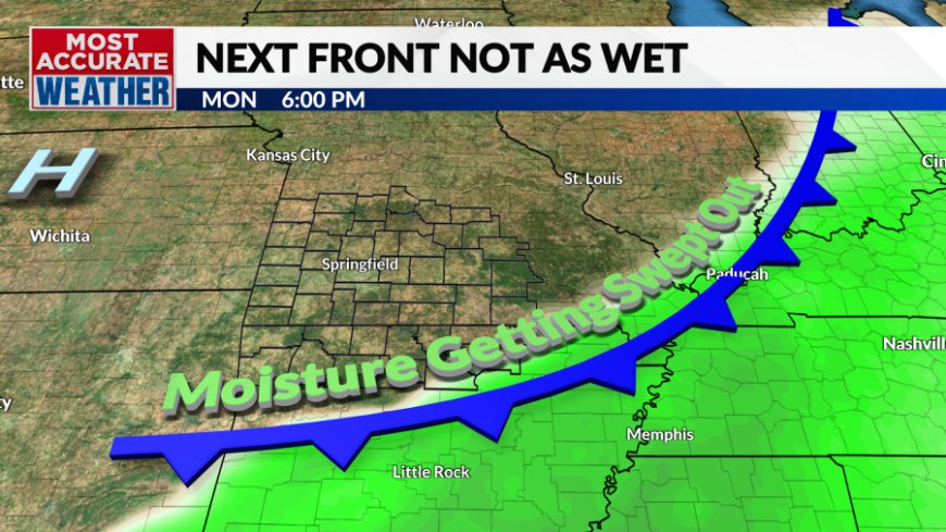
Another cold front will sweep in Tuesday night. The rapid succession of cold fronts won't leave a lot of time for the atmosphere to recharge with moisture limiting rain chances.


We're done with the rain for a while after Tuesday night and temperatures will get colder. It looks like we're in for another roller coaster ride with a cold Wednesday giving way to milder weather Thursday before a more extended period of cold through the weekend.


The pipeline of cold air will once again shut down approaching Christmas with milder weather through the Christmas holiday. There will also be another storm just ahead of Christmas, likely soaking the area just ahead of Santa's big ride.
What's Your Reaction?


