Monday, December 16 forecast: Skies clearing behind morning rain
Its been a busy weather weekend! Thunderstorms in Benton County produced an EF-0 tornado Saturday afternoon bringing our annual tornado count in Missouri to 105 preliminary tornadoes. We begin this morning with scattered thunderstorms producing locally heavy rainfall and frequent lightning. Rain and storms this morning will linger through around 7AM in Springfield. After that, [...]

Its been a busy weather weekend! Thunderstorms in Benton County produced an EF-0 tornado Saturday afternoon bringing our annual tornado count in Missouri to 105 preliminary tornadoes. We begin this morning with scattered thunderstorms producing locally heavy rainfall and frequent lightning.


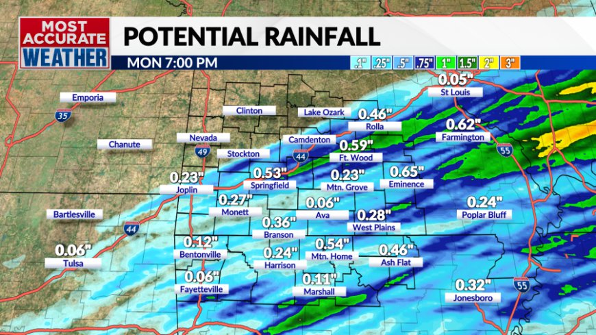
Rain and storms this morning will linger through around 7AM in Springfield. After that, the rain will move southeast and clear southern Missouri before noon. Northern Arkansas will clear not long after that also.


Behind the rain, skies will become sunny this afternoon but temperatures will feel chilly with a breezy northwest wind. Temperatures will settle in the low 50s this afternoon.
We'll be near freezing tonight and Tuesday will be mild in the mid-50s with a breezy south wind.


Another cold front will push through Tuesday night bringing another round of scattered rain and thunderstorms south of I-44. This will also cool us off on Wednesday.


We're done with the rain for a while after Tuesday night and temperatures will get colder to end this week. Expect highs in the 30s and 40s Friday through this weekend as another cold front drops south through the Ozarks.


What's Your Reaction?


