


Tuesday, July 15 forecast: Daily downpours give way to hot & dry weather this weekend
Expect scattered showers and thunderstorms today and Thursday, with a significant change to a sunnier and hotter pattern by the weekend, bringing mid to upper 90s temperatures and high humidity.
Another day, another round of scattered downpours. The spotty rain has been most abundant south of I-44 over recent days, but managed to pop up north of the interstate early Tuesday afternoon. Thankfully, the rain hasn't persisted too long in any one spot, given how heavy the downpours have been. There was a report of 1" of rain in 15 minutes at Bingham Elementary (east of Glenstone on Cherry St.) early Tuesday afternoon.


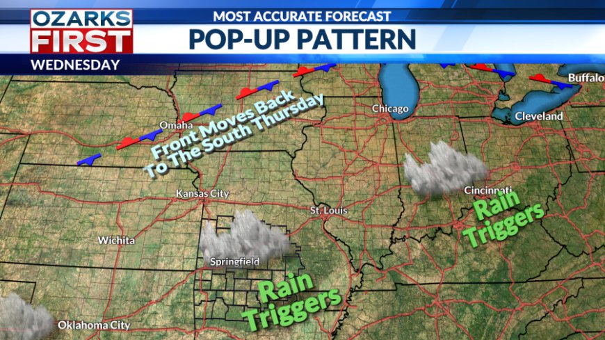
The wet weather ingredients will become a little less focused on Wednesday as the frontal boundary drifts north of the area. That said, we'll still bubble up another batch of widely scattered showers by the afternoon hours. Temperatures will likely creep a little higher with more locations hitting 90°.


We'll shift back into a wetter mode of weather by Thursday as the front slips back to the south. Showers will likely move in from the north Thursday morning, before fading. The day as a whole looks cloudier with scattered showers and thunderstorms flaring back up Thursday afternoon. The cloudier, wetter pattern will likely trim the afternoon highs back a bit.


A significant change to the pattern will occur by the weekend. A summer ridge will expand west across the southern half of the U.S. This will also shut off the rain highway and shift it and the frontal boundary back to the north. The end result will be a sunnier and hotter pattern starting Saturday and continuing into next week.

Rain chances will fall off to near zero over the weekend and remain there into next week. The other side of this pattern change will be the heat, with high temperatures climbing to the highest levels of the summer so far by next week. Afternoon highs next week will be in the mid to possibly upper 90s with feels-like temperatures in the 100 to 105° degree range. This will be the most intense heat wave of the summer so far, and it looks like it may linger through most of the rest of the month.

What's Your Reaction?


