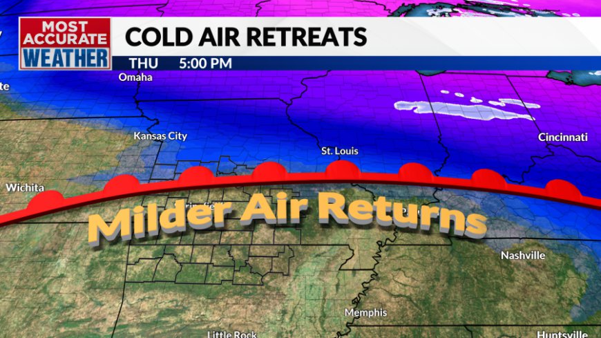
Wednesday, December 11 forecast: Cold today, mild tomorrow
Today's cold came with an early wave of clouds and yes, some snow showers. The snow fell in areas north and northeast of Springfield with some spots picking up a dusting. Clouds cleared with bright skies and cold conditions through the afternoon. Now we get ready for a cold night ahead of a big temperature [...]

Today's cold came with an early wave of clouds and yes, some snow showers. The snow fell in areas north and northeast of Springfield with some spots picking up a dusting. Clouds cleared with bright skies and cold conditions through the afternoon. Now we get ready for a cold night ahead of a big temperature rebound.

Skies will be clear with light winds and temperatures tumbling into the 20s. Lows will tend to be near or shortly after midnight with temperatures slowly climbing through sunrise.


The rise in temperatures will come as warmer air makes a quick move back to the north. A bright day and breezy southwest winds will push temperatures well into the 50s Thursday afternoon.


Our next chance of rain is lining up for Friday afternoon through Saturday morning. Light showers or sprinkles will show up over Southwest Missouri by late afternoon Friday. The overnight hours should be wet as waves of showers move through. Light rain or drizzle will continue into Saturday morning before tapering off by early afternoon. The remainder of the day will remain cloudy east of Hwy. 65 with some sunshine developing to the west.

This will be a soaking rainfall with most areas picking up between a quarter and three-quarters of an inch.
Temperatures both Friday and Saturday will be governed by cloud cover and rain. Saturday afternoon will feature the biggest range in highs with 50s to the west and 40s to the east.

We'll end the weekend with sunshine and milder weather. Again, clouds could play a role in just how warm, but right now it looks bright enough for highs well into the 50s, possibly near 60°.
Another front will sweep through Monday with a chance for showers and possibly some thunder. Temperatures into early next week will run above normal but will trend chillier through the middle of the week when another storm may move through.
Looking ahead through Christmas, the Canadian pipeline of cold air may set back up for the end of next week before shutting off again in the days leading up to Christmas. There's no sign of significant winter weather through Christmas and a white Christmas is not expected. The pattern looks quiet and seasonable for Christmas Day.
What's Your Reaction?


