


Wednesday, July 16 forecast: A couple more days of rain before heat invades
Another dose of downpours hit the area on Tuesday, producing pockets of heavy rainfall. Heavy rain on the east side of Springfield led to localized flooding. Scattered showers are possible again today, although not expected to be as widespread as yesterday. Rain chances slump a bit today because the stationary boundary that's been draped across [...]
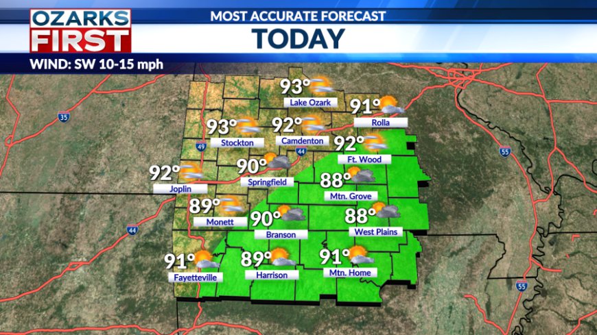
Another dose of downpours hit the area on Tuesday, producing pockets of heavy rainfall. Heavy rain on the east side of Springfield led to localized flooding. Scattered showers are possible again today, although not expected to be as widespread as yesterday.


Rain chances slump a bit today because the stationary boundary that's been draped across the Ozarks will drift slightly to our north. Temperatures will likely be a little warmer today, with many spots making it up to 90°.


A stronger cold front is charging its way through the Northern Plains today and will reach the Ozarks on Thursday. The cool air won't make it to town, but the front will pass through the Ozarks. This raises rain chances on Thursday morning and afternoon, and a little on Friday.


![]()
A significant change to the pattern will occur by the weekend. A summer ridge will expand west across the southern half of the U.S. This will also shut off the rain highway and shift it and the cold front back north out of the area. The end result will be a sunnier and hotter pattern starting Saturday and continuing into next week.

Rain chances will fall off to near zero over the weekend and remain there into next week. Afternoon highs next week will be in the mid-90s with feels-like temperatures in the 100 to 105° degree range. This will be the most intense heat wave of the summer so far, and it looks like it may linger through most of the rest of the month.

What's Your Reaction?


