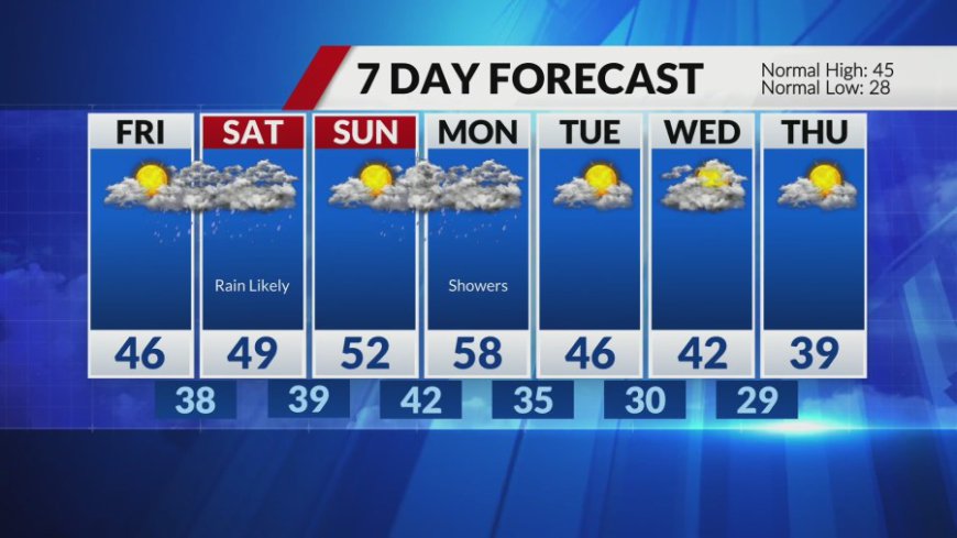
Colder for Thursday followed by warming trend and weekend rain chances
ST. LOUIS -- Clouds are moving into the region and a few flurries are possible across mainly northeast Missouri into central Illinois. While much of the morning will be mostly cloudy, clouds should decrease through the afternoon. Temperatures will be colder today, not making it out of the 30s. The warmup begins tomorrow with highs [...]

ST. LOUIS -- Clouds are moving into the region and a few flurries are possible across mainly northeast Missouri into central Illinois. While much of the morning will be mostly cloudy, clouds should decrease through the afternoon. Temperatures will be colder today, not making it out of the 30s.
The warmup begins tomorrow with highs back into the mid-40s with a mix of clouds and sun. Widespread rain is likely beginning overnight Friday and through much of the day on Saturday. Rainfall amounts look to stay less than 1" and more likely closer to the ½" to ¾" range. Highs on Saturday will be in the upper 40s to near 50. On Sunday, we'll see sunshine return and highs in the low 50s.
What's Your Reaction?


