Heat eases after Tuesday, real relief arrives in a week
After a week of scorching temperatures and drought conditions, a cool front is expected to bring rain and cooler temperatures to the area, with the worst of the summer heat potentially behind us by the end of the week.
Hot weather has scorched the area since the middle of last week. High temperatures have been in the upper 90s the past four days, something we haven't seen in a couple of years. The onset of drought conditions is also enhancing the hot temperatures. The prescription for all of this is rain and a cool front, and we'll see a little of both over the coming week.

The first cool front will arrive late in the day Tuesday. Pockets of shower and thunderstorm activity will be associated with the front, with a chance for rain throughout tonight into Tuesday, although much of the time will remain dry.


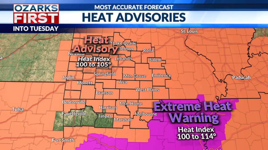
There should be ample time Tuesday for temperatures to again soar, and a Heat Advisory does remain in effect, extended one more day to account for this. Afternoon highs will be in the mid-90s with "feels like" temperatures as high as 105°.

Drier air will flood the area Wednesday, shutting off rain chances for most. It should be noticeably less humid, but afternoon temperatures will still make it to 90°. The rest of the week will read from the same playbook. Look for it to be bright and warm.

The weekend will arrive with more heat and an uptick in humidity as another cool front approaches from the north. This might be enough to trigger some spotty shower and thunderstorm activity closer to Central Missouri.

The front will sweep south of the area by Sunday with even drier air flowing in. More importantly, much cooler air will also flow in with highs below 90° Sunday and only in the low 80s as we get back to work next week.
After this week, the worst of the summer heat may be behind us.
What's Your Reaction?