Rain dissapears and heat lingers, but big heat relief is showing up in a week
Rain showers and thunderstorms will continue into this evening before fading by midnight, bringing welcome relief from the heat with afternoon highs in the upper 80s and low 90s, and lows in the low to mid 60s, though another dry stretch is expected to start soon.
Another day of feast or famine, with some lucky locations receiving rainfall. With the good comes some bad, though, with stronger storms producing strong winds and frequent lightning. The rainfall was welcome, though, especially as we enter another long dry stretch.

Today's round of showers and thunderstorms will continue into this evening before fading around midnight. A pocket of dry, stable air over Southwest Missouri will tend to keep rain out of much of Southwest Missouri. But, rain chances aren't zero with spotty showers and thunderstorms possible as far west as I-49.


In the wake of tonight's cool front, we'll find an easing of the heat with afternoon highs in the upper 80s and low 90s. The overnights are where you may notice a real increase in comfort with low humidity air, opening the door to lows in the low to mid 60s.


Another dry stretch gets started as well, with no rain expected through Friday.
They're may be a little bump in rain chances Saturday, though, mainly closer to Central Missouri as the next cool front arrives.

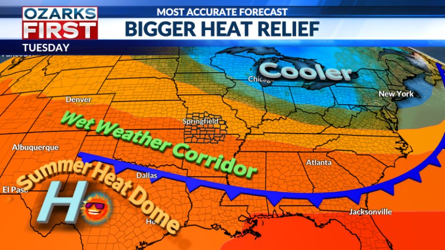
The weekend cool front will deliver real heat relief with the coolest weather since at least the beginning of the month. We can look forward to a long stretch of highs below 90° and maybe even a day in there with highs below 80°. Cool overnight temperatures are also on the table, with some mornings dipping below 60°.
Stingy rain chances will come with the front Saturday, but it may lay the foundation for better rain chances next week as it stalls to the south.
What's Your Reaction?