Summer sizzle fizzles as an early fall feel develops
A cool front is bringing an end to a 12-day heatwave in Springfield, with temperatures expected to drop 15 degrees and humidity levels to decrease, making for a pleasant weekend.
Finally, a break in the heat! We need it after 12 straight days with highs over 90°. We've hit 97° the past two afternoons in Springfield, making for the hottest streak since August of 2023.
The heatwave is also ending with a bit of a bang. Scattered storms fired up in the intense afternoon heat. A few of these produced some damaging wind gusts and small hail, along with very heavy rainfall. We got a report out of Falcon, MO (southeast of Lebanon) of 2.5" of rain in about one hour.

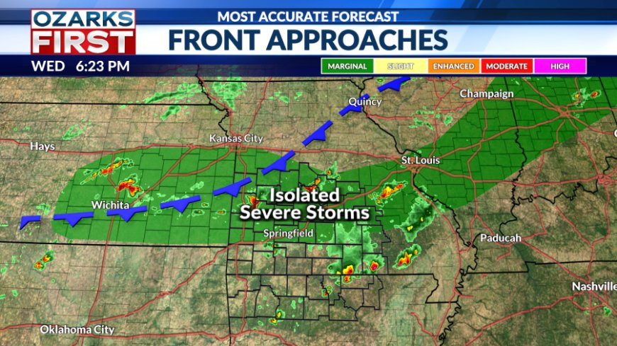
The cool front is still located up near I-70. South of the front, it will remain warm and humid, keeping the risk for showers and thundestorms alive throughout the night.


The front will gradually sink south through the area through Thursday night with drier air slowly filtering in on the backside of the front.


Look for Thursday to have a much different feel and look than recent days. Clouds will be widespread with scattered showers and a few thunderstorms possible at times throughout the day. It looks like there will be a gradual shift in rain coverage to the south heading into late afternoon. Afternoon highs will be running about 15° cooler.

Most of the rain will be gone Thursday night, save for a risk of showers across Northwest Arkansas. Skies will try to clear from the north with temperatures cooling into the low 60s up near Lake of the Ozarks. Near and south of Hwy. 60, clouds will probably hold tough, keeping overnight lows a little warmer.

Clouds should continue to thin throughout the day on Friday with mostly sunny and mild weather during the afternoon. The icing on the cake will be the noticeable drop in humidity.

It's a great start to what should be a beautiful weekend. This will be ideal weather for summer camping, or for just about anything outside. Humidity levels will remain low and temperatures will continue to run about 10° below normal.

Enjoy it while you can, though. Mild spells this time of the year don't hang around too long, and we'll find temperatures gradually climbing next week. Initially, the pattern will tend to hold back the excessive heat lurking to the west. But, as winds become more southwesterly later next week, hot weather will flood back in.

As for rain chances, they should remain low through the first half of next week thanks to drier air in place.
What's Your Reaction?