Clinging to summer heat ahead of a fall preview
Last night's cool front didn't come with the heat relief that many hoped for, with afternoon highs back above 90° in many spots. But, not to worry, we just need a bigger dose of Canadian air, and we'll find that moving in this weekend. The first cool did help, trimming afternoon highs by almost 10°. [...]
Last night's cool front didn't come with the heat relief that many hoped for, with afternoon highs back above 90° in many spots. But, not to worry, we just need a bigger dose of Canadian air, and we'll find that moving in this weekend.

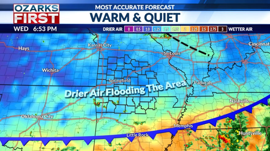
The first cool did help, trimming afternoon highs by almost 10°. Drier air flooding in will also make for a comfy, cool start to Thursday.

The drier air isn't just flowing in at the surface; the whole atmosphere is drying out. This will tamp down rain chances to almost zero for the next couple of days.
Rain chances will perk up a little on Saturday as the next cool front approaches. It should be a good day to get out on the water, just keep an eye on the sky for a pop-up afternoon storm.

The front won't be a drought buster, but it will give us a real taste of early fall temperatures. Readings early next week will be around 10° below normal, with lows in the 50s and low 60s and highs in the upper 70s and low 80s. These are readings more typical of the third week of September.
It looks like we may get through all of next week with highs below 90°, and we may be able to get through the rest of the month without the summer sizzle.

Saturday's front will also lay the foundation for a wet weather highway to get established in the region as the front stalls. Waves of rain and thunder will likely travel down the highway across Kansas and Oklahoma. At this point, the wet corridor looks like it will extend into Arkansas, keeping the best chance for welcome rain south of the state line.
What's Your Reaction?