Heatwave ending with rain and cooler weather
After experiencing the hottest day in nearly two years, 715 days to be exact, the dreaded heat dome is finally starting to loosen its grip. Slightly cooler temperatures and increasing chances of rain are just around the corner. Now, don’t get too excited. It’s still going to be warm today, just not as toasty as [...]
After experiencing the hottest day in nearly two years, 715 days to be exact, the dreaded heat dome is finally starting to loosen its grip. Slightly cooler temperatures and increasing chances of rain are just around the corner.

Now, don’t get too excited. It’s still going to be warm today, just not as toasty as what we've dealt with the last couple. Temperatures will peak into the lower to mid-90s under a fair mix of sun and clouds.

Flood watches have been issued for Northern Missouri and parts of Iowa, where a low-pressure system is expected to deliver heavy rainfall just north of the Ozarks. While extreme rain isn't expected for our area, these storms will act as rain triggers for showers and storms locally.


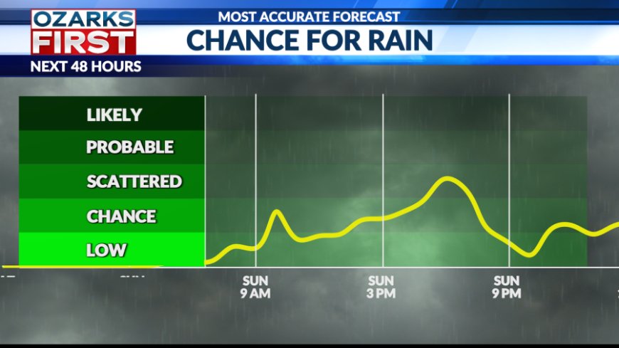
Starting Sunday and continuing into early next week, we’ll see near-daily chances for scattered showers and isolated thunderstorms. No single day looks like a total washout, but the pattern could bring much-needed rainfall.


The heaviest rainfall totals are expected north of I-44, with amounts tapering off the farther south you go in our viewing area.

These rain chances will help keep temperatures slightly cooler. Highs should hold in the low 90s through midweek before gradually warming as we head into the weekend.
What's Your Reaction?