


Monday, July 14 forecast: Showery pattern shifts back into summer sizzle mode by the weekend
This summer has been marked by showers and near to below normal temperatures, but a summer ridge will expand across the southern half of the U.S. by the weekend, bringing sunnier and hotter conditions with afternoon highs climbing into the low to mid-90s.
So far, this summer has been marked by showers and near to below normal temperatures. The bouts of heat have been short, but that may change as we move into the second half of July.

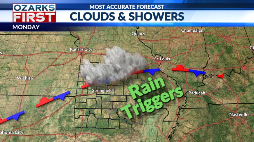
Clouds and showers kept temperatures well below normal through the weekend. This was thanks to a stalled front and a highway of rain triggers passing overhead. The overall pattern will change slowly throughout the week as the front tries to wobble back to the north through Wednesday, only to get nudged back to the south on Thursday. This will keep a daily chance for showers and thunderstorms going through Friday.


No day will be a washout, and generally, amounts will be light. But there could be a few spots that pick up some locally heavy rainfall amounts. Severe weather is also not expected, but there could be a few isolated instances of strong wind gusts. Rain chances will peak during the afternoon and evening each day as temperatures climb into the upper 80s to around 90°.


A more significant change to the pattern will occur by the weekend. A summer ridge will expand west across the southern half of the U.S. This will also shut off and shift north the highway of rain triggers. The end result will be a sunnier and hotter pattern.


Rain chances will fall off to near zero by Sunday and Monday, with afternoon highs climbing into the low to mid-90s. This coming weekend into next week is shaping up to be our hottest stretch of weather yet this summer.
What's Your Reaction?


