


Summer sun sizzles as temperatures continue to climb
An extreme heat warning remains in effect through Thursday as a summer ridge builds, bringing temperatures into the 90s and heat indices into the 100s, while a weak boundary could bring a chance of rain and cooler temperatures by the weekend.
The first true heatwave of 2025 has settled in and is planning an extended stay across the region. This will bring us a case of summer doldrums with temperatures remaining the main headline throughout the week.
A summer ridge will continue to build north into the region through Thursday, leading to a steady climb in temperatures.

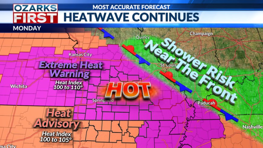
In the short term, a frontal boundary draped near I-70 has been teasing areas to the north with a few showers and thunderstorms. That boundary should lift further north through Monday, taking rain chances with it. Hot weather will continue across the region with highs back in the low to mid 90s on Monday, with heat indices in the 100 to 106° range. An Extreme Heat Warning remains in effect through at least Thursday.


The pattern and the forecast don't change much through Thursday. We'll probably add a degree or two each day to the high as the summer ridge strengthens and conditions continue to dry out across the area.

There may be an opportunity for more clouds and even a little rain starting Friday and continuing through the upcoming weekend. An area of unsettled weather will move around the summer ridge before shifting east through Missouri and into Illinois through Sunday. This should weaken the ridge somewhat, and it may also push a weak boundary into the area.

All of this would add up to at least a low risk for some rain and more cloud cover, and this may even trim back the heat a bit.

At this stage, this looks like only a small speed bump in what will overall be a hot and mostly dry pattern through the end of the month.
Stay cool and stay safe everyone!
What's Your Reaction?


