


Monday, July 21 forecast: Multiple days of heat & humidity in our future
Happy Monday! The weekend notched two 90° days into our annual total, bringing us up to 11 so far for the year. Each day this week will likely be in the low to mid-90s with heat index values between 100° to 110°. An extreme heat warning is in effect through Thursday. In the short term, [...]
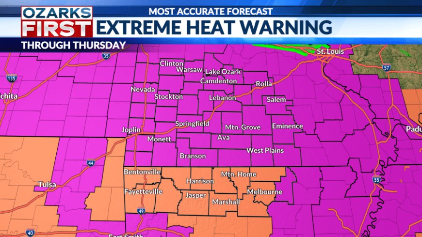
Happy Monday! The weekend notched two 90° days into our annual total, bringing us up to 11 so far for the year. Each day this week will likely be in the low to mid-90s with heat index values between 100° to 110°. An extreme heat warning is in effect through Thursday.

In the short term, a frontal boundary draped near I-70 has been teasing areas to the north with a few showers and thunderstorms. Flooding is becoming a problem for areas near and west of St. Louis. This boundary will be kept at bay by an expanding heat dome in the Ozarks. No rain is expected through Thursday.


Temperatures each day this week will be in the low to mid-90s. We'll likely find a pattern where we add a degree a day to the afternoons. This is a cycle within heat domes. Hot air is trapped under the high pressure, causing the atmosphere to get hotter over time. This is similar to putting a lid on a pot.


![]()
There may be an opportunity for more clouds and even a little rain starting Friday and continuing through the upcoming weekend. An area of unsettled weather will move around the summer ridge before shifting east through Missouri and into Illinois through Sunday. This should weaken the ridge somewhat, and it may also push a weak boundary into the area.


At this stage, this looks like only a small speed bump in what will overall be a hot and mostly dry pattern through the end of the month.
What's Your Reaction?


