


Thursday, July 17 forecast: Rain today, hot and humid tomorrow
Today is looking ripe for scattered rain and thunderstorms, both this morning and this afternoon for parts of the Ozarks. Conditions are favorable for thunderstorms thanks to a cold front dropping south into the area today. Rain and thunderstorms can initially be expected north of I-44 before noon, while areas south of I-44 can expect [...]
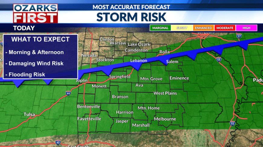
Today is looking ripe for scattered rain and thunderstorms, both this morning and this afternoon for parts of the Ozarks. Conditions are favorable for thunderstorms thanks to a cold front dropping south into the area today.

Rain and thunderstorms can initially be expected north of I-44 before noon, while areas south of I-44 can expect rain and storms after noon. There is a chance that some storms on either side of the interstate become severe. Gusty winds of 50-60 mph are the primary hazard, along with very heavy rain and flooding.


Other than the rain, today will be cooler thanks to generally cloudy skies. The air is still very humid, so we'll still feel the mugginess. Winds will be light from the southwest.

A risk for showers and thunderstorms will probably persist overnight, especially over West Central Missouri, due to the stalled frontal boundary.

Friday will be a transition day with the departing front still delivering rain chances and somewhat cooler afternoon highs. At the same time, hot and dry weather will be building in from the southwest.


A summer ridge of high pressure will continue to bully its way into the Ozarks this weekend. Temperatures will soar into the mid-90s beginning Saturday. Feels like temperatures beginning on Saturday will be between 100° to 105°. Rain chances evaporate to near zero.


This will be an extended period of heat and humidity. Your body will get stressed in this environment. Practice common sense by staying hydrated and taking breaks from working outdoors more often.
What's Your Reaction?


