Outlook remains hot, and mostly dry until a cool front approaches
A wave of clouds and showers brought cooler temperatures to the area on Wednesday, but temperatures are expected to rise again on Friday, with highs in the mid to upper 90s and "feels like" temperatures around 100°, and rain chances minimal until a cool front arrives early next week.
We got a little help with the heat from Mother Nature today. A wave of clouds, and even some showers, spilled south through the area on Wednesday. This knocked temperatures back a bit during the afternoon, with readings cooling from the low 90s into the upper 80s.

The helping hand with the heat came from a big wave of storms that passed by to the north. Those storms produced a boundary that was steered south into the Ozarks, and it could be a scenario to watch for again on Thursday.


For tonight, we'll find starry skies and warmer overnight temperatures that won't drop below 70° across much of the area. Meanwhile, to the north, another batch of showers and thunderstorms is expected to develop between Topeka and Des Moines. The focus for wet weather will remain north of the Ozarks, but leftover clouds and even a few showers may try to once again spill in from the north during the day.


Friday is shaping up to be a scorcher. Skies will remain bright with the summer ridge pumping up temperatures further. Afternoon highs will likely rival the highest levels of the year so far with afternoon readings in the mid to upper 90s. "Feels like" temperatures will top out around 100°.

Not much change is expected this weekend. Mostly sunny skies and hot temperatures will continue to be the main headlines. Lows will be in the low to mid 70s with highs in the mid to upper 90s. Rain chances will be minimal with isolated showers more likely closer to Central Missouri.


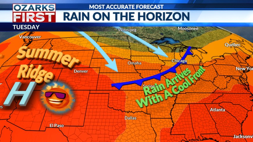
We need more rain than what's being offered up through the weekend, and Mother Nature may come through early next week. A dip in the jet stream will slip east across the northern half of the nation, and it looks deep enough to get a cool front into the region. The front will be a cloud and rain magnet, generating daily rounds of scattered shower and thunderstorm activity Monday through Wednesday.
What's Your Reaction?