


Thursday, July 17 forecast: Last call for rain on Friday
Expect a wet start to the day with showers and thunderstorms, followed by a transition to hot and dry weather on Friday, with temperatures rising into the mid-90s by the middle of next week.
A grumbly, wet start to the day gave way to a mix of sun and clouds that came with a tropical feel. The morning rain kept us from 90°, but it still managed to get warm with afternoon highs in the mid to upper 80s, along with loads of humidity.


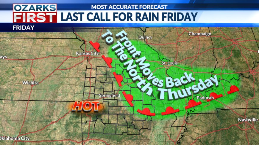
The morning rain pushed a boundary south into Arkansas. It will be this boundary that will serve as a possible focal point for showers and thunderstorms tonight into Friday. This is a last call scenario with the rain set to shut off with an extended dry stretch to follow.


Heading through tonight, the risk for showers and thunderstorms will grow across Southwest Missouri and Northwest Arkansas as the boundary begins to lift to the north. Scattered showers and thunderstorms should shift east across the area through sunrise, possibly making for a wet start to the day Friday for some.


Friday will be a transition day with the departing front still delivering rain chances and somewhat cooler afternoon highs to the east and northeast. At the same time, hot and dry weather will be building in from the southwest. For most, this will be our last shot at rain for at least a week.


Saturday marks the beginning of the long, hot stretch. Hotter, drier air will invade the area with sunnier skies pushing temperatures into the mid-90s. There may be a sneaky shot at some clouds and showers early in the day near Lake of the Ozarks, but even there, skies should be bright with hot temperatures during the afternoon.

The summer ridge will continue to settle in and should be located directly over the region by the middle of next week. This will keep rain away and lead to a gradual climb in afternoon highs. Look for mid-90s early in the week, with upper 90s becoming more likely by the second half of next week. These will easily be our hottest temperatures of the summer so far, and it will come with heat indices that will top 100°.

Time to get prepared for this extended period of excessive heat. Make sure your AC is running properly and that you have adequate water and shelter for outdoor pets. This will also be a stressful period for your body when doing outdoor activities. Remember to stay hydrated and take breaks when working outdoors more often.
The heatwave will likely stick around into the following weekend, but there are signals that it could ease some as we near the end of the month of July.
What's Your Reaction?


